The Best Topographical Land Surveys are the most accurate, the most precise and most cost effective. They must include the correct level of detail and must be surveyed and delivered in the most appropriate format.
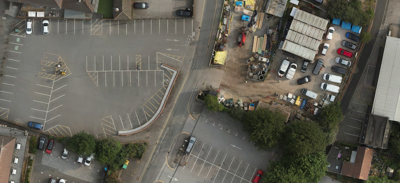
We produce high resolution geo-referenced images that can be used in CAD software.
These images can add context and give our clients the added confidence that nothing is missing.
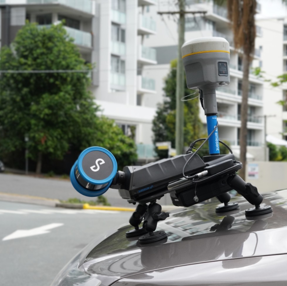
Our method for undertaking Topographical Surveys involves using experienced surveyors, combined with modern technology including Total Stations and GPS/GNSS for site survey control. Drones (UAVs) with Photogrammetry and Laser Scanning payloads and Terrestrial Laser Scanners, including the very latest in SLAM Technology enabling, detailed data capture, linking to the Ordnance Survey (OS) grid.
Ensuring clear communication with our Clients and their Consultants to define precise requirements (accuracy, detail, deliverables, including grid selection and scale factor) for the project, focusing on the right tech mix for site size, complexity and intended use of the deliverables.


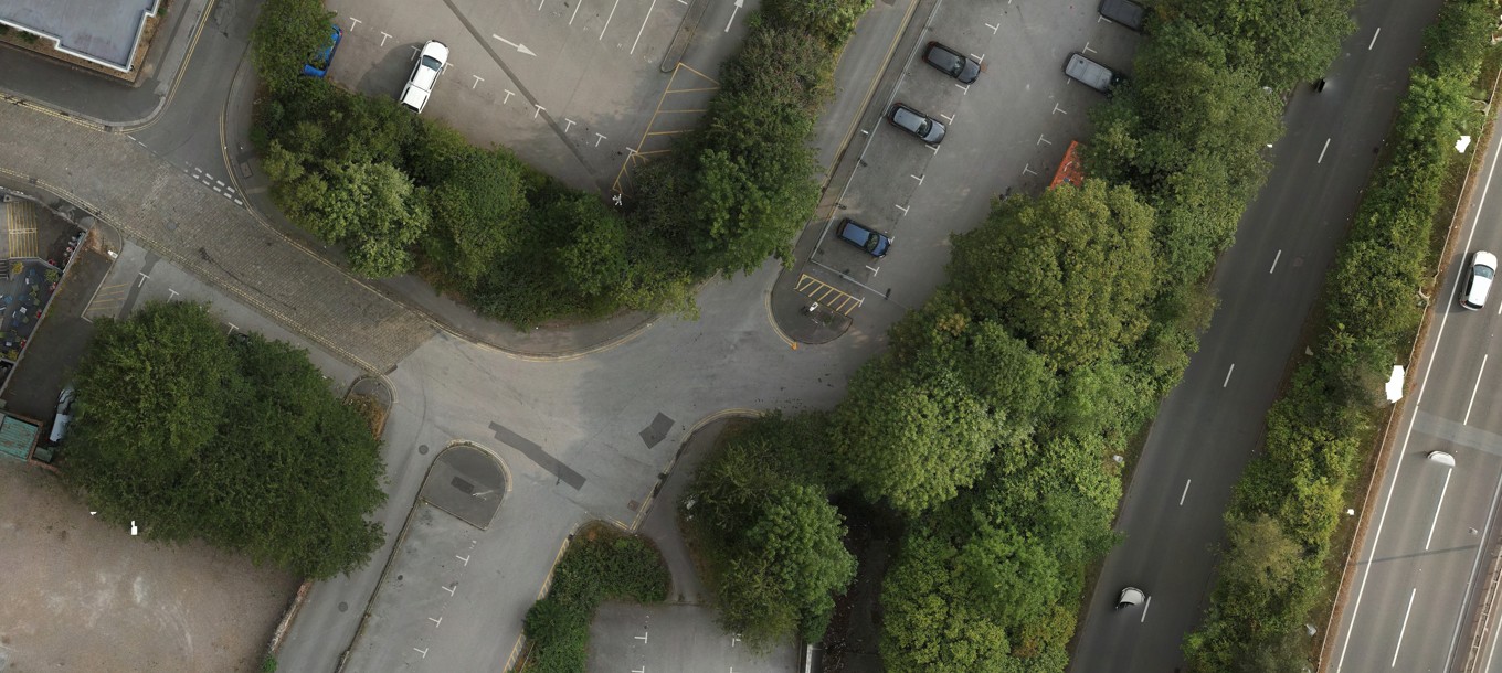
The image above shows detail captured both above and below ground.
And finally processing the data through to CAD software (AutoCAD), and other 3D modelling packages.

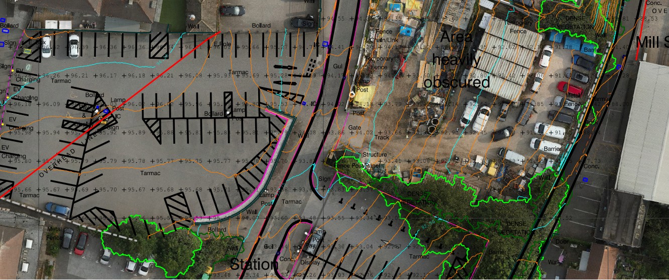
Typical final deliverable CAD in 3D format.
1. Preparation & Planning:
- Define Requirements: Clearly communicate with architects, developers, or owners to understand project goals, required accuracy, level of detail (contours, features), area extents, and desired output (DWG, PDF).
- Site Assessment: Plan data collection, considering weather, site access, and potential hazards, risk assessment for surveyor safety, Be aware of CDM regulations. If surveyors are walking on busy highways, who has organised traffic control? Is there an alternative? Consider using remote surveying, it’s safer and likely to be more accurate, why take the risk?

If it is safe to walk we would use a backpack mounted method.
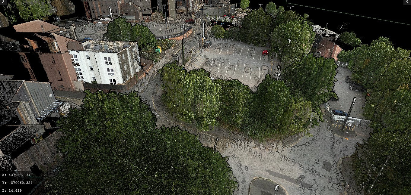
Image above shows raw data, captured using our backpack method. This is raw unfiltered data, look closely and you can see the surveyor.
2. Data Capture (On-Site):
- Establish Control Network: Use GPS/GNSS and Total Stations to set precise reference points tied to the national OS grid. Always our preferred option. However, local grids and scale factors need to be considered. We understand co-ordinate transformation and geoids. We also understand why Architects work in millimetres and Surveyors work in meters and we know the likely outcome when someone forgets!
- Technology Mix:
- Total Stations/GPS: For precise positioning of features like site survey control.
- Drones (UAVs): Ideal for large, complex, or hard-to-reach areas, providing high-resolution aerial imagery and 3D models.
- Laser Scanning (LiDAR): Captures incredibly accurate and detailed point clouds, excellent for complex surfaces and inaccessible spots, producing accurate 3D models.
- SLAM Technology: Utilising, not only SLAM algorithms but also GPS and unlike other SLAM scanners we are also able to include points derived from our Trimble Total Stations and our Riegl Scanners, ensuring millimetre accuracy.
- Point Cloud to CAD to your Specification: Using specialist software we convert our data to CAD vector lines, contours, buildings, roads, break lines, and watercourses. With individual points including spot levels, trees, and any other features.
- Comprehensive Data: Capture includes all visible features, elevations, contours, man-made structures, and above ground natural elements. Below ground or underwater can also be included.
3. Data Processing & Delivery:
- CAD Software: After processing the raw data we use software to convert to AutoCAD, to create accurate digital plans (DWG files) and 3D models.
- Quality Control: Senior staff quality-check all processed data and deliverables.
- Deliverables: To give context to the DWG and PDF’s we also supply 3D user friendly models and panoramic images. See our info on RiPANO, Aura and Agisoft Viewer.
4. Key Factors for Our Success:
- Experienced Surveyors: Skilled professionals using the latest, appropriate technology are crucial for accuracy.
- Technology Choice: Select the right combination (Total Station, Drone, Laser Scanner) based on site size, terrain, and project needs.
- Communication: Clear dialogue with stakeholders ensures the survey meets all project specifications.
- Avoid Cost-Cutting: Don’t choose a surveyor solely on price; cheap surveys often lead to costly rework.