News


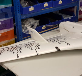
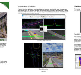
AIMS take delivery of the 1st Wingtra One PPK in the UK

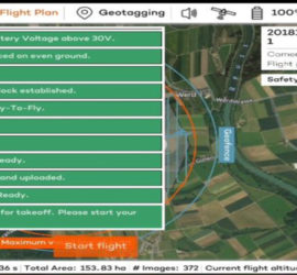
AIMS have now been operating the Wingtra One PPK for over 16 months surveying over 50 large sites around the UK. The Wingtra One PPK the safest and most accurate VTOL drone, for mapping and surveying. Combining vertical take-off and landing with long range flights, it carries the best in […]


AIMS Joins Mining Surveys (UK)

Aerial Inspection & Mapping Surveys Ltd is now a wholly owned subsidiary of Mining Surveys (UK) ltd. The logo is just the first of our changes. In line with MSUK philosophy of  inovation and advancement in the field of geomatics and striving to increase safety in the workplace whilst keeping […]


AIMS Works on Last Deep Coal Mine in Britain

The Last deep coal mine in the UK has been capped off three months after its closure. Kellingley Colliery in North Yorkshire closed in December 2015, bringing to an end centuries of deep coal mining in Britain. It took a team of men including ten former workers, 3 hours to […]


Multirotor Mapping Drone For Sale

Fantastic Package Includes everything needed to start surveying and mapping! ONE HOUR AND FORTY MINUTES OF FLIGHT TIME Reduced to £3,500 Sky Hero Little 6 . Sky Hero Little 6 UAV (with gimbal) GoPro Hero Black Eight batteries Two Taranis X9D Plus Controllers A flight video screen FPV Headset Multi […]


About Us

Aerial Inspection and Mapping Surveys Ltd was formed in 2015, to provide a safe and modern surveying and design service. AIMS works with specialist survey grade equipment and surveyors with over 30 years’ of experience. The company considers that today we remain at the forefront of surveying, mapping and measurement […]


Civil Aviation Authority approved

Mining Surveys, TLS and AIMS Have Joined Forces

Mining Surveys, Terrestrial Laser Scanning and Aerial Inspection & Mapping Surveys have all merged to create a power-house in scanning and mapping techniques. Offering a variety of different services, you will be able to find a solution to all your surveying problems right here. The merger allows you to have […]


LSS Software Now Gives You More Control Over Your Point Cloud Data

If you want to have full control over the survey data we provide, McCarthy Taylor’s LSS software can now help. The update which costs an extra £250 per year, allows the user to handle point cloud data at a very low cost. Aims believes this can change the market quite […]