It’s worth it for professionals like us, focused on fast, high-accuracy mapping and surveying, especially we need to cover large areas efficiently and require reliable data without constant use of ground control points.


The upgrade offers improved construction, flight safety, and landing precision, faster data capture, longer flight times for increased area coverage, and is highly flexible with available payloads like high-resolution RGB and LiDAR sensors.
landing accuracy has improved and gives us much more confifdence on sites with limited take-off and landing sites.
Benefits of Upgrading
- Increased Efficiency and Speed:
The Gen II’s longer flight times and faster flight speeds significantly reduce the number of flights and relocations needed for surveys, leading to quicker project delivery.

- High Accuracy without GCPs:
The WingtraOne Gen II uses built-in PPK GNSS to provide professional survey results with high absolute accuracy, often eliminating the need for ground control points (GCPs).

- Versatile Payload Options:
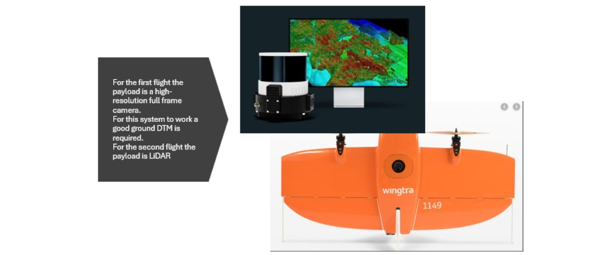
The system is designed for flexibility, allowing for various high-end payloads, including different cameras and a precision LiDAR sensor, to suit diverse mapping needs.
- Streamlined Workflow:
It’s a continuously improving, end-to-end solution from flight planning to data processing, making the entire aerial mapping workflow more streamlined.
- Reliability:
The drone is described as a go-to for demanding mapping applications that require reliable, high-accuracy coverage, offering consistent results on every flight.
We consistently need high-accuracy, reliable data for large areas and will benefit from the Gen II’s efficiency and precision.
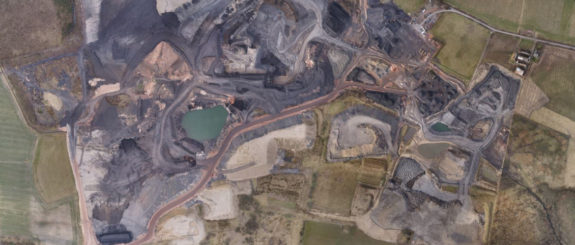
The drone’s speed and accuracy are ideal for time-sensitive data capture in construction, mining, and development planning.
The Gen II is not designed for tasks that require continuous data capture in hover mode, like some inspection projects. We have our M300 for that.
While the initial cost might be high, the efficiency and speed gains can lead to significant returns by decreasing man-hours and costs on projects.
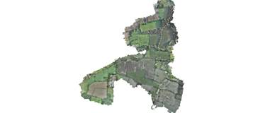
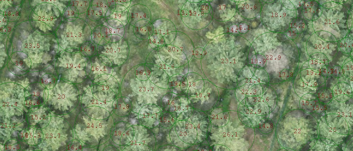
Our projects often exceed 200ha.