Our opinion is; if you require the best results use both. And use both terrestrial and aerial data capture.
Photogrammetry uses photos to create 3D models, excelling in rich color/texture and cost-effectiveness, while LiDAR uses lasers for highly accurate, structure-focused point clouds, penetrating vegetation for detailed terrain mapping even in poor light, though it’s pricier and less visual. Think of photogrammetry for realistic visualization and LiDAR for precise measurement and complex environments like forests. Many projects benefit from combining both: LiDAR for geometry, photogrammetry for realism.
Photogrammetry
- How it works: Stitches overlapping photos to build 3D models (passive sensing).
- Strengths: High visual detail, color, texture; cost-effective; great for design, progress tracking, and documentation.
- Weaknesses: Light-dependent (needs good lighting); struggles with dense vegetation; can be slower to process.
- Best for: Construction, architecture, visual inspections, cultural heritage.
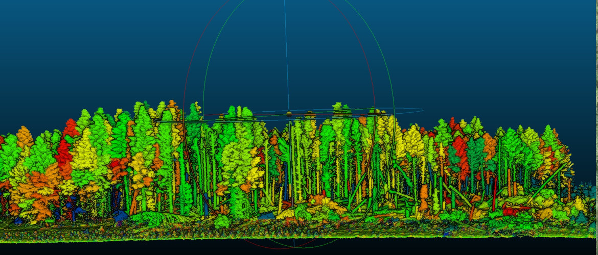
The site shown below had very dense vegetation and required accurate ground levels and detail of ditches, fences and other structures.


A section through the area shows just how much of the ground is missing using only photogrammetry.
LiDAR
- How it works:
Emits laser pulses to measure distances, creating precise point clouds (active sensing).
- Strengths:
High accuracy (sub-millimeter); penetrates foliage; works in low light/poor weather; fast data capture.
- Weaknesses:
Less inherent color/texture (though can be colorized); more expensive hardware; higher processing power needed.
- Best for:
Forestry, flood modeling, large infrastructure, detailed terrain, utilities.
Which to choose?
- For realistic visuals & budget: Choose photogrammetry.
- For precise measurements & complex terrain: Choose LiDAR.
- For best of both: Use both, combining LiDAR’s accuracy with photogrammetry’s visual richness.
The same section showing both Photogrammetry and LiDAR.

Even when using aerial LiDAR some detail may still require additional data capture. In this case we would utilise a ground based mobile mapping system.

Backpack mounted scanners are very quick, accurate and cost effective. Missing data can get expensive.
Giving our clients reports and spreadsheets, showing the accuracy of our survey control is standard but often it is not understood, giving them visual aids showing what we have surveyed helps.