
We undertake land surveying of golf courses using advanced technologies like GPS, drones, LiDAR and SLAM technology to create detailed maps for design, maintenance, and management. These surveys provide highly accurate data on topography, features, and vegetation, enabling precise planning for redesigns, drainage, tournaments, and other course-related decisions. The process can be costly but offers valuable insights for improving course performance and player experience.
Key aspects of golf course surveying
- Technology used:
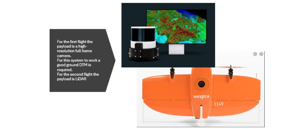
- Drone (UAV) surveys: Drones equipped with high-resolution cameras and scanners to capture aerial imagery and LiDAR data for detailed topographic maps and 3D models.
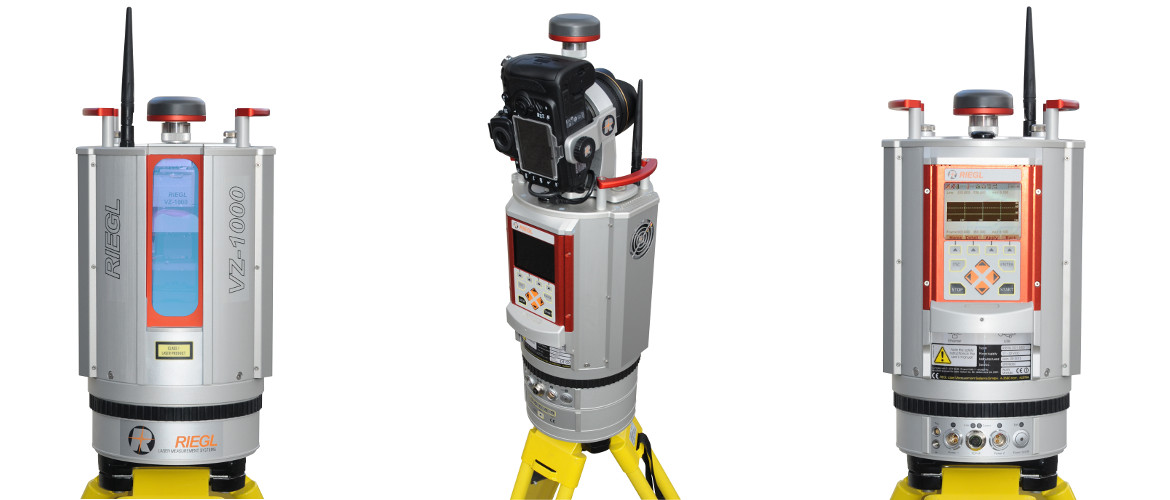
- 3D LiDAR laser scanning: This technique rapidly gathers millions of precise measurements to create detailed 3D representations of the course. Usually ground based terrestrial scanners mounted of tripods or vehicles.
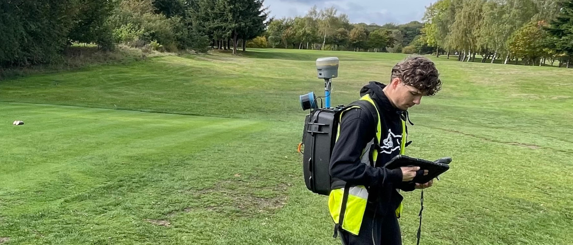
- SLAM Scanners: This technology allows the scanner to be mounted on a backpack, drone, vehicle and handheld. This method provides a fast, accurate and cost effective method for surveying and mapping golf courses.
- High-precision GPS: Both static and Real-Time Kinematic (RTK) GPS systems are used to achieve centimeter-level accuracy for mapping and monitoring.
- Other equipment: Robotic total stations and precise digital levels are also used to measure features with speed and precision.
Purpose and applications:
Course design and redesign: Provides a detailed base map for architects to plan changes.
- Drainage and earthworks: Enables precise calculation of volumes for cut and fill projects.
- Tournament preparation: Supports planning and accurate mapping for large-scale events.

- Course management: Offers insights for improving player experience and overall course performance.
- Plant health analysis: Some surveys can analyse vegetation health to inform decisions on fertilizer and water application.
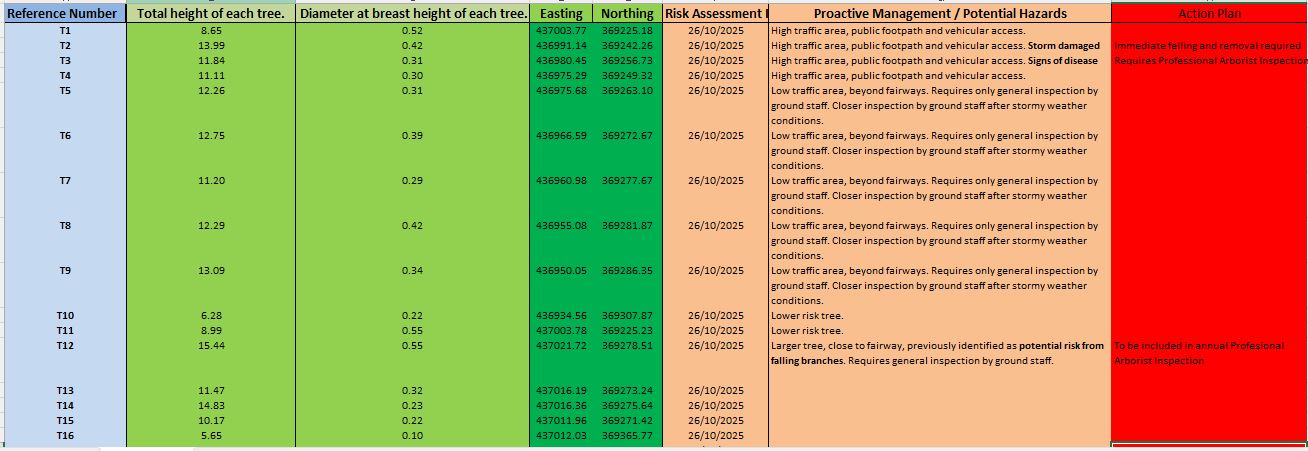
- Risk Management: Our surveys can provide detailed analysis of trees on the course and provide the basis for risk management.
Why risk assessment is necessary
Trees in public places should be risk assessed to ensure public safety and fulfil legal duties.
Risk assessments are necessary to identify potential hazards like disease or structural weakness, evaluate the likelihood of harm, and implement control measures, especially in high-traffic areas like golf courses, parks, near roads, and public footpaths.
Trees on golf courses should be risk assessed to ensure the safety of players and staff, and to comply with legal obligations.
Risk assessments help identify and mitigate hazards from dead or unstable branches, diseases, and root problems, which can prevent injuries, legal liabilities, and damage to property.
Our surveys can provide the basis for
- Legal obligation: Landowners, including public authorities, have a legal duty of care to take reasonable steps to manage and reduce the risk posed by trees. Failure to do so can lead to penalties if an incident occurs.
- Public safety: Assessments help identify trees that could fall, posing a risk of injury or property damage.
- Proportionality: A risk assessment helps determine the right level of inspection and management based on the tree’s condition and the level of public access to the area.
- Addressing specific issues: Assessments are crucial for identifying threats from storm damage, tree disease, and structural defects.
Key reasons for tree risk assessment on golf courses
- Safety: To prevent injuries to golfers, staff, and spectators from falling branches or uprooted trees.
- Legal compliance: To fulfill a legal “Duty of Care” to ensure the property is safe for its users.
- Liability protection: To avoid legal and financial consequences if an accident occurs due to a neglected tree hazard.
- Course maintenance: To manage the health of the trees, which also enhances the course’s aesthetics and playability by improving sightlines and air circulation.
- Strategic planning: To develop a long-term strategy for tree care, which can make budgeting easier and prevent reactive emergency work.
How risk assessment is conducted
- Zoning: Areas are categorized based on the level of public access. High-use areas (e.g., footpaths, fairways, tees and greens) are prioritized for more frequent and detailed inspections than low-use areas.
- Inspection frequency: Hazardous trees, particularly those in high-traffic zones, should be inspected at least annually. Less frequently used trees may require less frequent checks.
- Professional expertise: While some inspections can be done by trained personnel like a tree warden, a formal risk assessment is typically carried out by a qualified arborist or specialist to identify and evaluate risks accurately.
- Documentation: All inspections and actions taken should be properly documented to demonstrate the duty of care has been met.
Key considerations during assessment
- Tree condition: Assess the tree for signs of decay, disease, or structural instability.
- Environment: Consider factors like soil conditions, weather exposure, and the tree’s proximity to people or infrastructure.
- Public use: Take into account the number of people who frequent the area, including whether children will be present, as their behavior can be less predictable.
- Other risks: In addition to falling trees, consider risks such as tree roots causing damage to pavements or utility lines, and roots obstructing visibility on roads.
What a risk assessment can include
- Tree health checks: Identifying diseases, pests, or decay.
- Structural assessment: Evaluating the stability of the tree and its limbs.
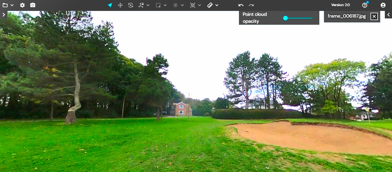
- Hazard identification: Pinpointing specific risks such as deadwood, cracks, or leaning trees.
- Location analysis: Considering the “target occupancy,” meaning how frequently people are in the area near the tree.
- Aesthetic considerations: Evaluating how trees contribute to the course’s design and appearance.
Survey outputs:
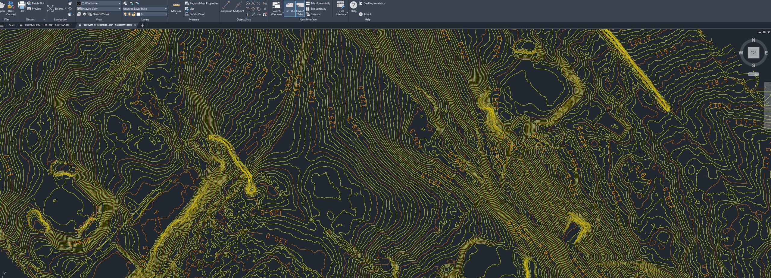
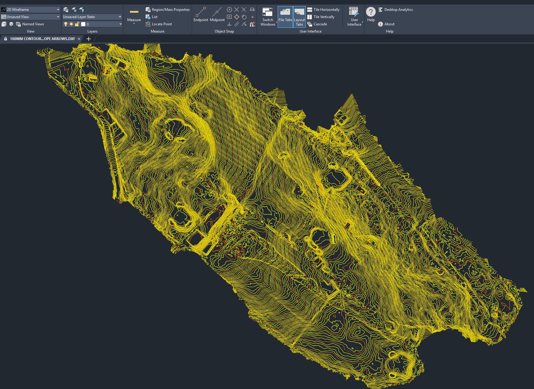
Topographic maps: Show contours, elevation changes, and other natural and built features.
- 3D digital elevation models: Allow for complex analysis and volume calculations.
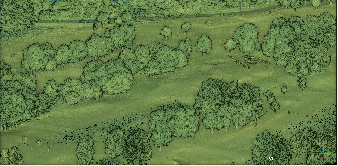
- Digital twins: Detailed 3D models of the asset.
- Orthomosaic images: High-resolution aerial images providing visual context.
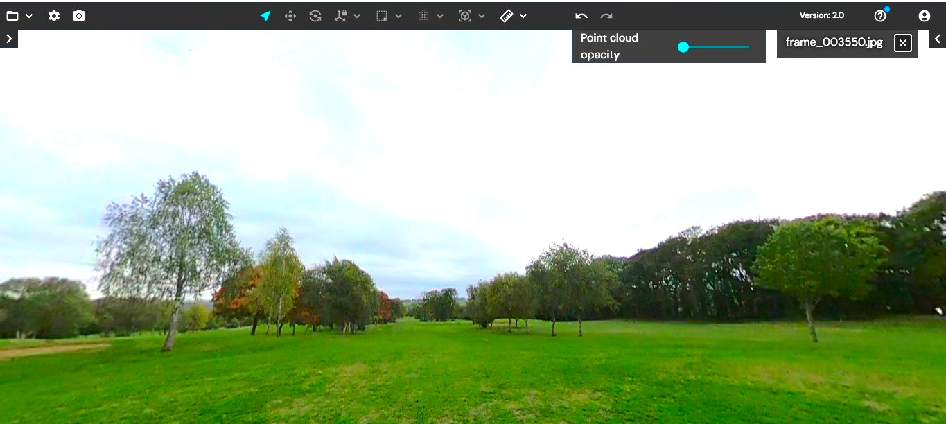
- Point clouds: Dense sets of data points that represent the course in 3D.
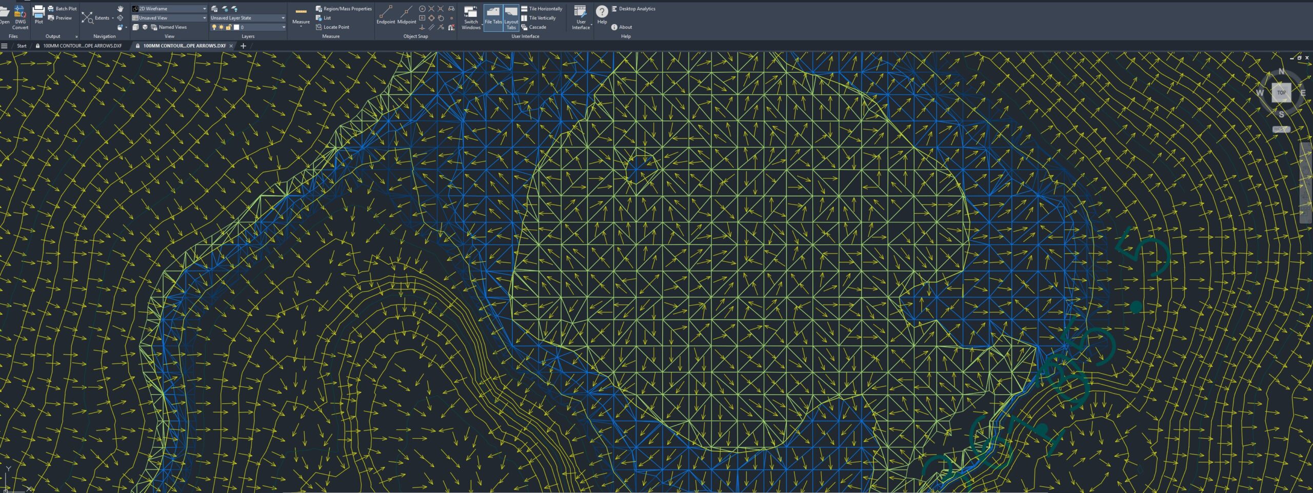
- Detailed slope analysis: Essential in evaluating greens.
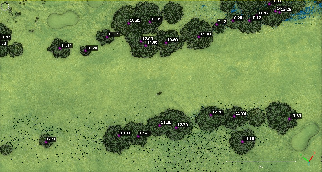
- Xcel Spreadsheets: Tree metrics, including tree location (XYZ), height, canopy, and diameter at breast height.

- Cost:
- Can be a significant investment, potentially costing upwards of £10,000 for a basic survey of an 18-hole course.
- Costs vary based on the site’s location and the level of detail required.
- Costs can be reduced significantly if SLAM or mobile technology is employed.