Back Home

Start making better decisions today, based on accurate aerial data

Start making better decisions today, based on accurate aerial data

  • Home
  • Services
  • News
  • Contact/Find Us
Home » Mining Surveys, TLS and AIMS Have Joined Forces


Next →
http://www.aerialinspectionandmapping.co.uk/wp-content/uploads/2015/03/20150325_151500edit-1024x438.jpg http://www.aerialinspectionandmapping.co.uk/wp-content/uploads/2016/03/Photo-alignment-angle-1024x377.jpg http://www.aerialinspectionandmapping.co.uk/wp-content/uploads/2016/03/LSS-3D-Quarry-Model-2-1024x594.jpg http://www.aerialinspectionandmapping.co.uk/wp-content/uploads/2016/03/20130529_115728-1024x768.jpg http://www.aerialinspectionandmapping.co.uk/wp-content/uploads/2016/03/waste-tip-1020x1024.jpg http://www.aerialinspectionandmapping.co.uk/wp-content/uploads/2016/03/Photoscan-4-1024x477.png http://www.aerialinspectionandmapping.co.uk/wp-content/uploads/2016/03/20140813_090421-1024x768.jpg http://www.aerialinspectionandmapping.co.uk/wp-content/uploads/2016/03/Erin-Filtered-Vegetation-9-1024x478.jpg http://www.aerialinspectionandmapping.co.uk/wp-content/uploads/2016/03/Civil-Aviation-Authority.jpg

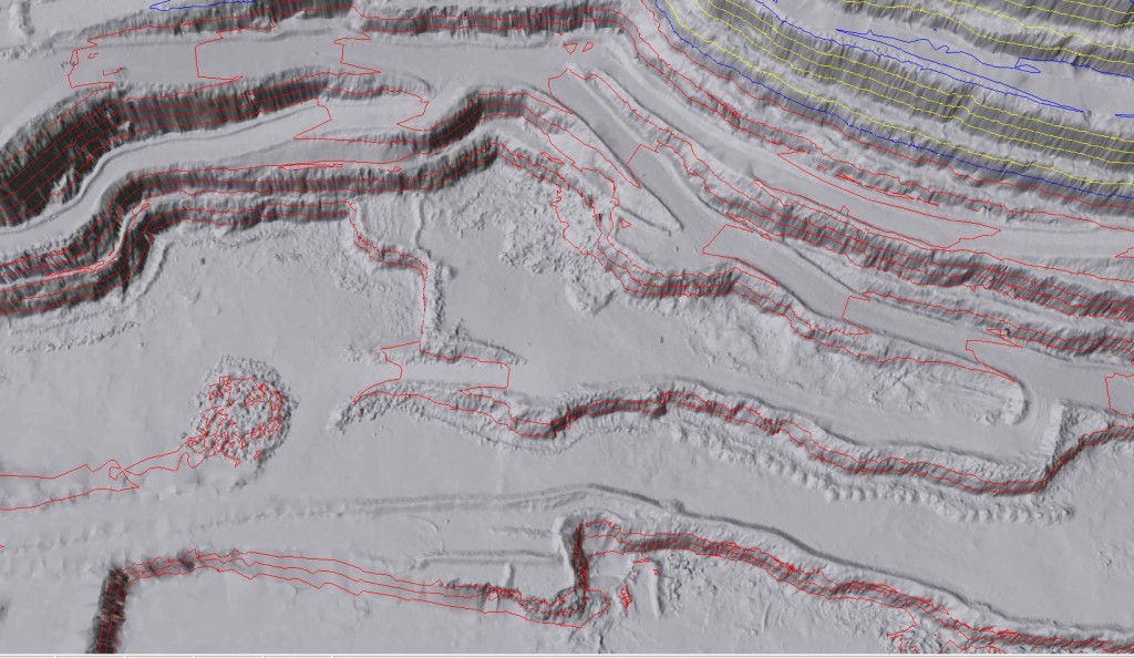
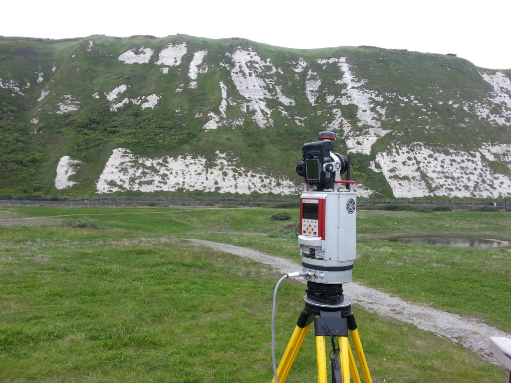
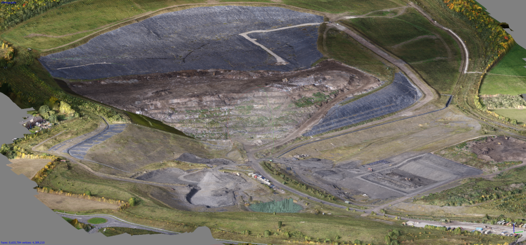
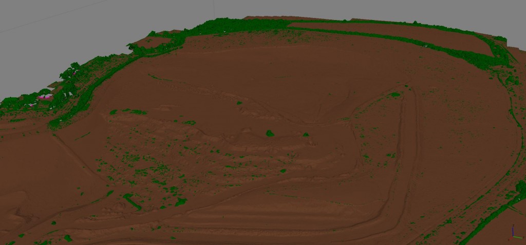
Our XR6 Hexacopter can capture sharp and high quality images to create plans for sites of any size

Leave a comment Cancel reply

Your email address will not be published. Required fields are marked *

This site uses Akismet to reduce spam. Learn how your comment data is processed.

Contact Us:

3, The Bridge Business Centre, Beresford Way, Chesterfield, Derbyshire S41 9FG 01246 268444

RSS AIMSurveys

  • The Best Topographical Land Surveys are the most accurate, the most precise and most cost effective. They must include the correct level of detail and must be surveyed and delivered in the most appropriate format.
  • Heritage site survey solutions
  • When should we use Photogrammetry and when should we use LiDAR?
  • Updateing Measured Building Surveys to include data capture methods using survey grade drones, terrestial laser scanners and SLAM Technology. And adding reality models to the list of deliverables.
  • Heritage Site Survey Solutions
  • Forestry: Asset verification, mapping, measurement and valuation.
  • Why did we upgrade to the new Hovermap STX. Because it combines SLAM and GPS for precise mapping making it, in our opinion, the best SLAM scanner on the market.
  • What is Reality Capture
  • Upgrading to the WingtraGen II.
  • Mapping in a very challenging environment.

· © 2025 AIMSurveys · Designed by Press Customizr · Powered by ·