Mining Surveys, Terrestrial Laser Scanning and Aerial Inspection & Mapping Surveys have all merged to create a power-house in scanning and mapping techniques.
Offering a variety of different services, you will be able to find a solution to all your surveying problems right here.
The merger allows you to have a choice of various services all in one place, from stock pile monitoring via the long-range scanner to photogrammetry over large sites with the XR6 Hexacopter. Having access to such diverse services in one go allows you to get the most out of your surveying requirements. All the results can also be output to fulfil any requirements from the survey, such as creating contour lines of the site or marking up levels.
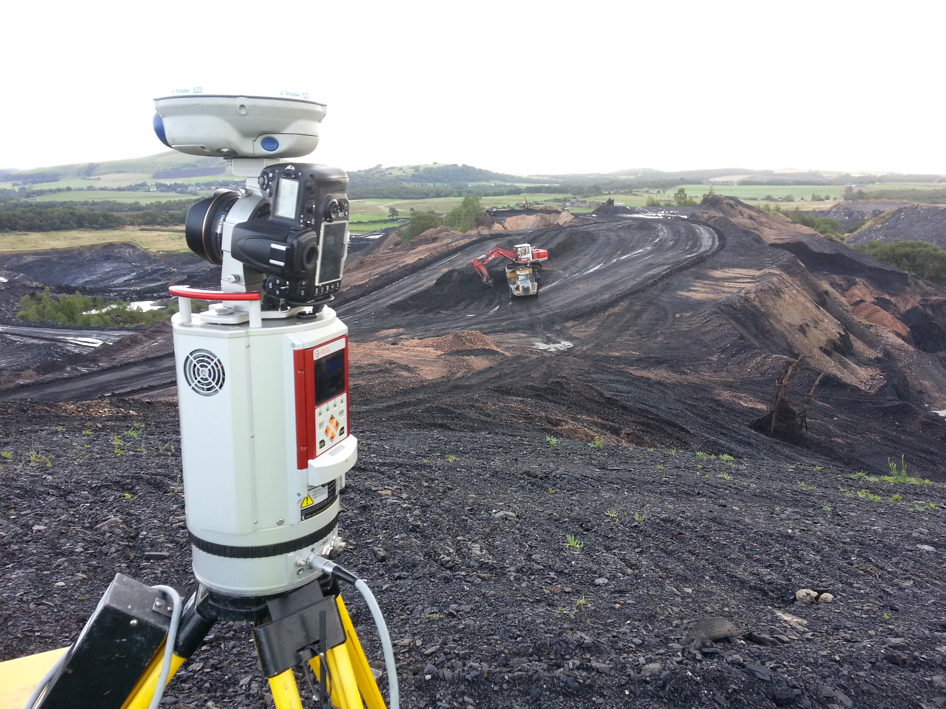
Have any type of terrestrial site surveyed with our long-range scanner
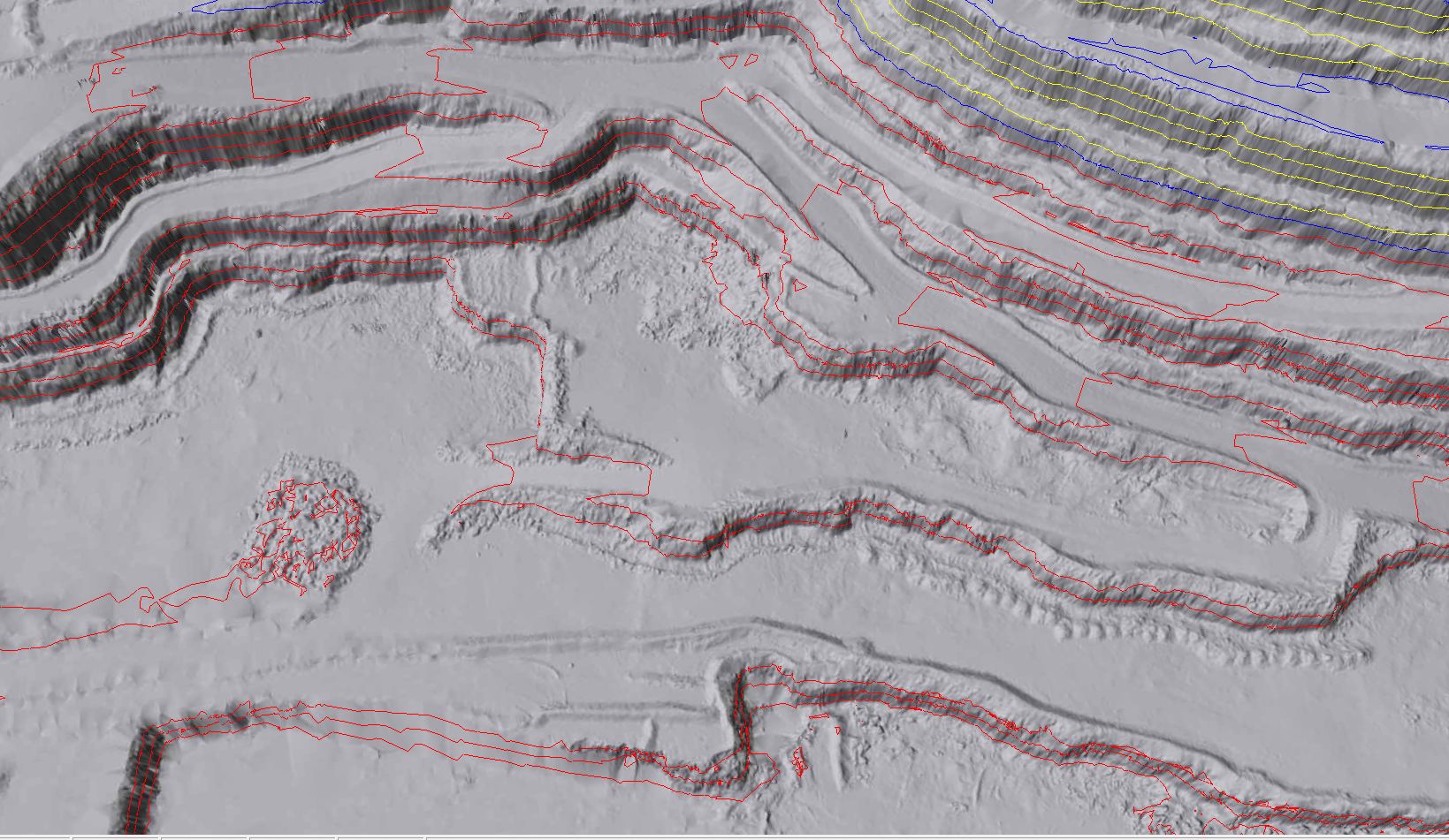
3D models of any site can be created along with contour lines
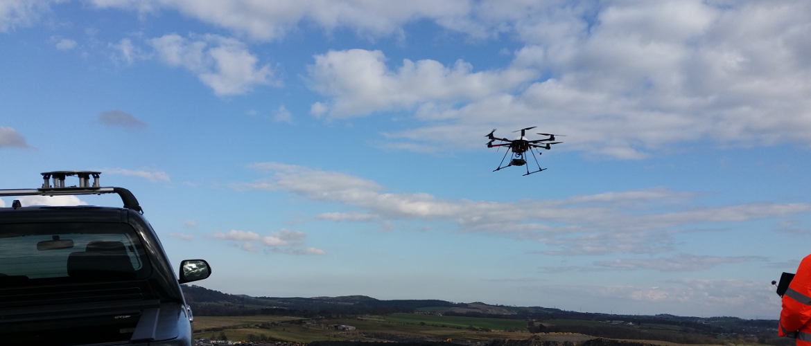
Our XR6 Hexacopter can capture sharp and high quality images to create plans for sites of any size
Mining Surveys’ long range scanner can scan up to distances of 1.4km, allowing a large amount of area to be surveyed at a single time. Dense point cloud data can be captured and analysed by our software to output various results from the survey. From measuring quarry face elevation to monitoring volumes of any kind of stock piles, the laser scanner can obtain any information required to complete a land survey. The results would allow you to analyse and plan what to do next to make the most of your terrestrial site.
Aerial Inspection & Mapping Surveys is a new addition to the world of surveying with dynamic technology. With our XR6 Hexacopter, we can inspect and map any kind of large area which needs to be surveyed. From the detailed images captured by our UAV, we can output 3D models as plans for our clients. From the aerial image of your site, we can create a large whiteboard for you to outline changes to the site to your staff members. Along with creating 3D models and plans from the images captured by the UAV, we can also create dense point cloud data from the images to be imported into software for manipulation, just like the laser scanner. The possibilities are endless with our UAV photogrammetry.
AIMS is CAA licensed and therefore fully qualified to undertake any aerial surveys with the XR6 Hexacopter. We have already had many successful surveys using the UAV, capturing many high quality images to create the perfect 3D model.

We are CAA approved!
If you have any questions or queries, please feel free to contact us.