Keeping cost down is always important to us, terrestrial scanners like our Riegl Scanners the VZ1000 and the VZ400i are normally our go to tools and offer sub 5mm accuracy but they are static scanners, and they are very expensive. I am not suggesting that SLAM scanners can replace these high resolution, high accuracy scanners but in situations where 20mm to 30mm is acceptable they are certainly worth a look.
Our first venture into SLAM technology was back in 2015 and it didn’t go well. There were big problems with accuracy caused by drift and we are not talking about millimetres we are talking 10 or 20 meters. There were also problems with the processing software. But the idea was great.
Things have moved on, a lot.
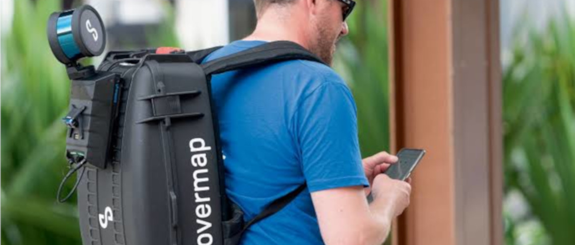
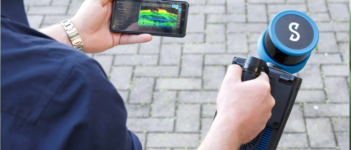
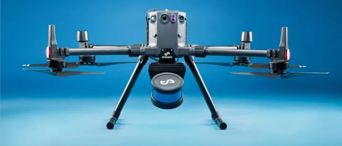
The Emesent Hovermap ST is praised for its survey-grade accuracy, even in harsh, GPS-denied environments, thanks to its advanced SLAM technology. It offers versatile deployment on drones, vehicles, and as a handheld device, providing autonomy and collision avoidance for safer, faster data capture. Its IP65 weather resistance and lightweight, composite design make it robust for tough conditions, while Aura software streamlines processing for improved efficiency and decision-making.
Key Advantages
- Survey-Grade Accuracy:
Achieves sub-centimeter precision in complex environments, even outperforming traditional terrestrial laser scanners (TLS) in some cases, thanks to its robust SLAM algorithms and automated ground control features.
- Versatile Deployment:
The one-cable, plug-and-play design allows users to easily switch between drone-based, handheld, backpack, vehicle, or robot-mounted configurations, providing flexibility for diverse applications.
- Harsh Environment Capability:
Its IP65 weather-sealed design and dust/splash resistance make it suitable for use in hostile environments where GPS is denied or unavailable.
- Efficiency & Speed:
The device enables rapid, continuous data capture, and Emesent’s Aura processing software provides efficient, real-time visualization and analysis, accelerating time to insight.
- Lightweight & Robust:
The redesigned, lightweight composite form factor makes it easier to integrate onto various platforms without compromising stability, especially during flight.
- Extensibility:
Supports accessories like a Long-Range Radio and colorization hardware, allowing for expanded capabilities and fleet integration.
Ideal Applications
Hovermap ST is ideal for applications requiring detailed 3D mapping in challenging conditions, such as:
- Underground infrastructure (tunnels, sewers)
- Industrial facilities
- Mining and construction sites
- Complex cross-section and feature-poor environments
- Public safety and asset inspection
One of our first assignments was to map underground ducts in a busy city centre.
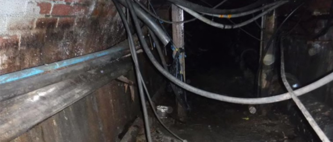
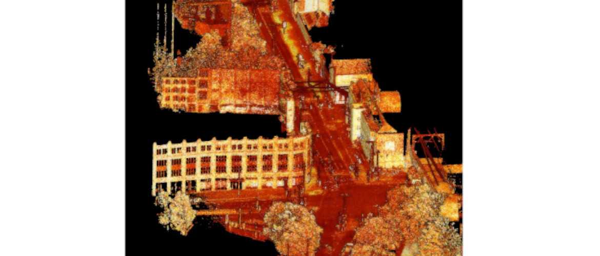
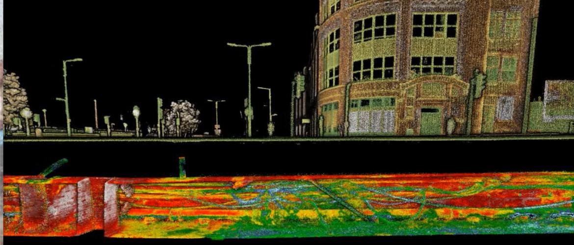
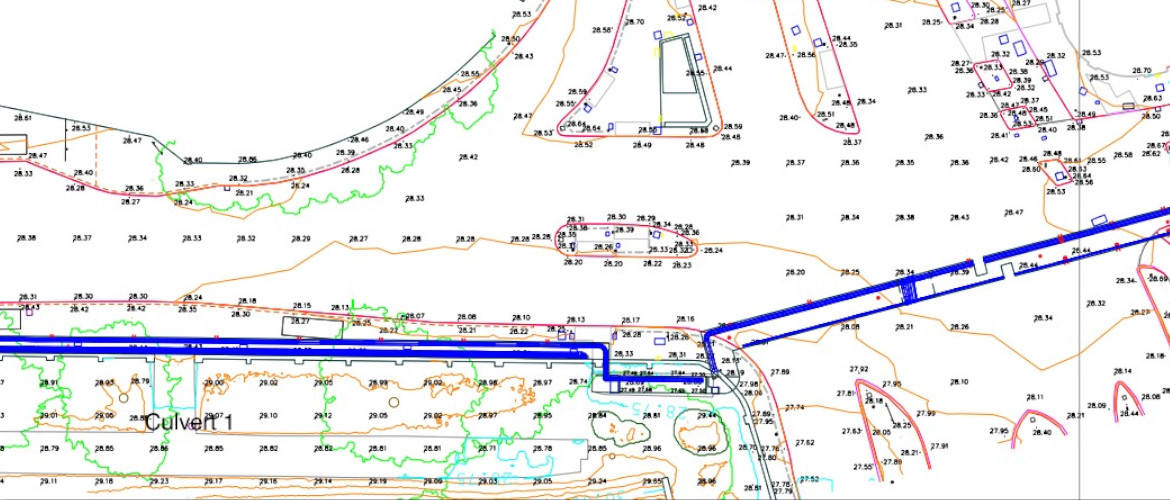
Accuracy of hard detail +/- 20mm checked against a Riegl VZ400i.