The Hovermap STX with GPS provides more accurate, higher-density 3D mapping with a 300m scanning range, double the laser sensors of the original ST model, and advanced GPS auto-geolocation for effortless alignment to coordinates. It offers faster data acquisition, improved accuracy, longer autonomous flight range in GPS-denied areas, and better performance for complex terrains and forestry by enabling the use of GPS for improved accuracy and easier workflow.
- Enhanced LiDAR Capabilities:
Features double the number of laser sensors (32 rings vs. 16) and a 300-meter scanning range, leading to significantly higher point density and faster data capture.
- Advanced SLAM Technology:
Utilizes world-leading Simultaneous Localization and Mapping (SLAM) algorithms for precise, real-time 3D mapping, even in challenging GPS-denied environments.
- GPS Auto-Geolocation:
Automatically aligns scans to GPS coordinates when integrated with a compatible drone, simplifying the process of creating accurate as-built models and digital twins.
- Autonomous & Versatile Operation:
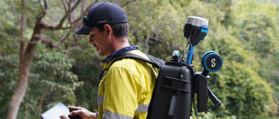
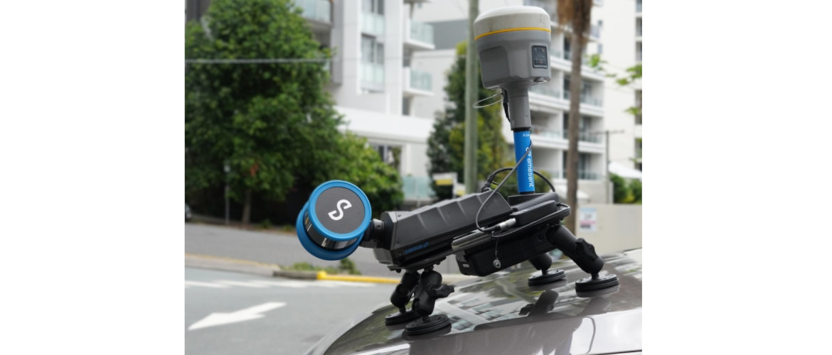
Enables fully autonomous drone flights, even beyond visual line of sight and communication range, and can be detached for handheld, backpack, or vehicle-mounted scanning.
- Real-time Visualization:
Live streams the point cloud data to a control tablet, allowing for real-time preview and ensuring full coverage and data quality.
What else makes It Better Than our old Hovermap ST
- Increased Sensor Count and Range:
The ST-X’s 32 laser rings and 300m sensing range (compared to the ST’s 16 rings and 100m range) provide much greater detail and cover larger areas in less time.
- Higher Data Quality and Accuracy:
With more sensors and an improved scanning range, the ST-X produces higher-resolution, more accurate point clouds with better-defined features and more precise mapping.
- Enhanced GPS Integration:
While the ST can integrate with GPS, the ST-X offers dedicated GPS Auto-Geolocation for effortless alignment to coordinates, which is crucial for large-scale projects.
- Improved Overall Workflow:
The combination of longer range, higher density, and integrated GPS leads to faster processing times, greater efficiency, and a more robust workflow for complex projects and challenging terrain.
Key functions and features
1. Combines SLAM and GPS for precise mapping
- Simultaneous Localization and Mapping (SLAM): Hovermap’s primary function is to use its LiDAR sensor to constantly map its surroundings while simultaneously tracking its own position within that map. This allows for autonomous operation and mapping in GPS-denied areas like underground mines, inside buildings, or under dense foliage.
- GPS Integration: In outdoor, open-sky areas, the integrated GPS can be used to achieve survey-grade accuracy. It provides absolute georeferencing to correct for any “drift” that can accumulate over long-distance SLAM scans, anchoring the LiDAR data to a global coordinate system.
- Automated Ground Control Points (GCPs): The system can automatically detect ground control targets placed at surveyed locations to further improve the accuracy and georeferencing of point clouds, removing the need for manual alignment.
2. Enables versatile and safe data capture
- Flexible deployment: The Hovermap’s quick-release, plug-and-play design means it can be mounted on a variety of platforms to suit the job:
- Drones: For automated aerial surveying and exploration of hard-to-reach areas.
- Handheld or backpack: For rapidly scanning ground-level areas or locations inaccessible to drones.
- Vehicles, poles, and robotic platforms: For mobile mapping in different contexts.
- Advanced autonomy: When mounted on a compatible drone, it offers multiple autonomous flight modes:
- Autonomous Waypoint Mode: Automatically navigates to user-defined points, maps the area, and avoids obstacles.
- Pilot Assist Mode: Provides a “safety bubble” with omnidirectional collision avoidance for closer, safer inspections.
- Live point cloud streaming: Operators can view a real-time 3D point cloud of the environment as it is being captured, ensuring complete coverage and allowing for on-the-fly mission adjustments.
Primary applications
- Geospatial and surveying: Quickly captures detailed, survey-grade topographical maps, especially in complex or vegetated areas where traditional methods are slower.
- Construction and engineering: Creates as-built models and digital twins of facilities, improving accuracy and accelerating project timelines.
- Mining: Used for safe and efficient mapping of hazardous and GPS-denied underground tunnels and stopes.
- Infrastructure inspection: Inspects assets like telecommunication towers and energy grids, reducing risks for personnel.
- Forestry and environmental monitoring: Collects detailed data on vegetation, as the LiDAR’s multi-return capability can penetrate forest canopies to reveal hidden ground details.
- Public safety and disaster response: Rapidly maps disaster zones or other hazardous environments without putting people at risk.