To measure trees accurately you need to deploy both photogrammetry and LiDAR-equipped devices on drones or backpack.
Photogrammetry provides ortho-rectified, geo-referenced images, visual verification of the asset.
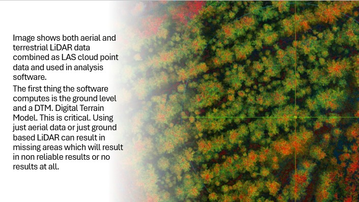
Drone mounted LiDAR penetrates the forest canopy to provide accurate measurements of individual tree spread and height and ground levels.
We know that the only way to obtain enough point cloud data to accurately measure forestry is by using our backpack mounted Hovermap.
Post-collection, we employ specialized software that analyses the point cloud to detect and segment individual trees, extract their stem profiles, and calculate metrics like diameter, height, and volume, creating a detailed digital twin of the forest.
We also employ Forestry Mensuration Professionals who understand the complexities of harvesting and valuation.
Data Collection Process
- Deployment:
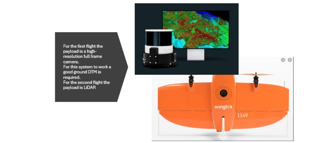
For sites above 50ha we prefer to use our Wingtra Gen 2 VTOL drone with a LiDAR payload for mapping tree location, canopy, height and ground surface. We also fly with a camera. For sites below 50ha we mount the Hovermap device on our DJI M300 and also on a backpack.
- Scanning:
The LiDAR scans the forest, emitting laser pulses that reflect off vegetation and the ground.
- Data Capture:
We produce a dense point cloud, which includes both above-canopy and under-canopy information, creating a 3D model of the forest.
The device’s Simultaneous Localization and Mapping (SLAM) technology ensures its position and navigation are tracked accurately, even in GPS-denied areas, providing a reliable dataset.
Data Analysis for Tree Measurement
- Tree Detection:
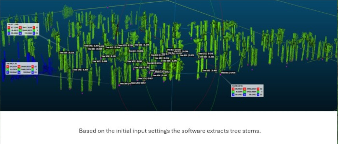
Specialized algorithms process the 3D point cloud to automatically detect individual trees.
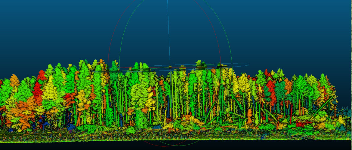
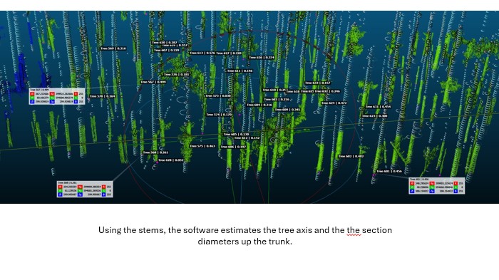
The algorithms identify and segment the stem of each tree from the data.
- Metric Calculation:
Once individual trees are identified and their stems are extracted, software can accurately measure:
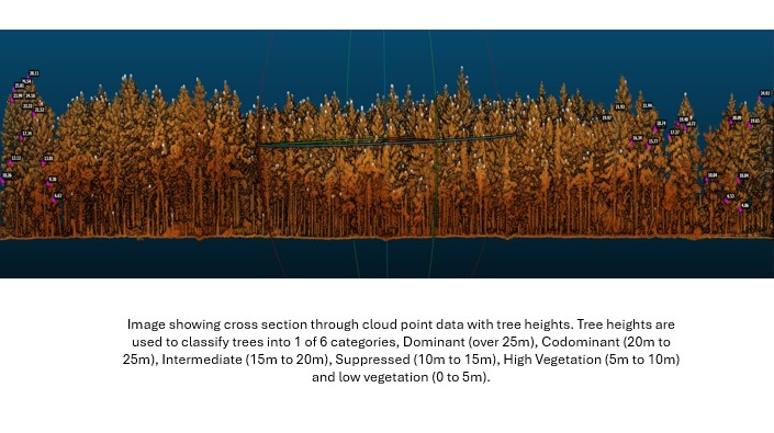
- Tree Height: Derived from the laser pulses that reach the ground through canopy gaps.
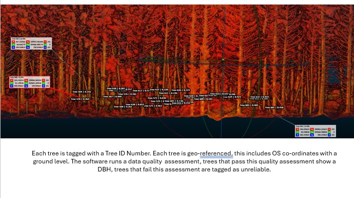
- Diameter at Breast Height (DBH): By analyzing the stem’s cross-section in the point cloud.
- Canopy Structure: The data also provides detailed information on the canopy’s structure.
- Tree Volume: This can be calculated by integrating the LiDAR data with taper curves, which model the shape of tree stems.
- Digital Twin Creation:
The final output is a high-resolution digital twin of the forest, providing a comprehensive visual and quantitative understanding of its components, such as stem form and volume.
