Back Home

Start making better decisions today, based on accurate aerial data

Start making better decisions today, based on accurate aerial data

  • Home
  • Services
  • News
  • Contact/Find Us
‹
›
Home » Private: Surveying and Mapping » Terrestrial Laser Scan Surveys

Recent Posts

  • SLAM vs VZ400i
  • The Best Topographical Surveys.
  • Photogrammetry or LiDAR
  • Measured Building Surveys.
  • Heritage Site Survey Solutions
  • Forest Mapping.
  • Best SLAM Surveys.
  • Reality Capture
  • Land Surveying Large Sites.
  • Cement Plant Surveys.

Services

  • Aerial Surveys
  • Environmental Monitoring
    • Flood Monitoring
    • Land Slide Monitoring
    • Visual Impact
  • Forest Mapping and Mensuration
  • Highway Surveys
  • Infrastructure Inspection
    • Structural Monitoring
  • Measured Building Surveys
  • Photography and Filming
  • Railtrack and Infrastructure
  • Reality Capture
  • Underground Mapping Services
  • Visual Impact
  • Deep Mine Surveys
  • Development Site Surveys
  • Electricity Grids & Distribution Networks
  • Hydrographic Surveys
  • Landfill
  • Oil & Gas Distribution and Infrastructure
  • Opencast Coal
  • Quarry Surveys
  • Stock Surveys
  • Terrestrial Laser Scan Surveys
  • Topographical Surveying

Terrestrial Laser Scan Surveys


When Flying is not an Option

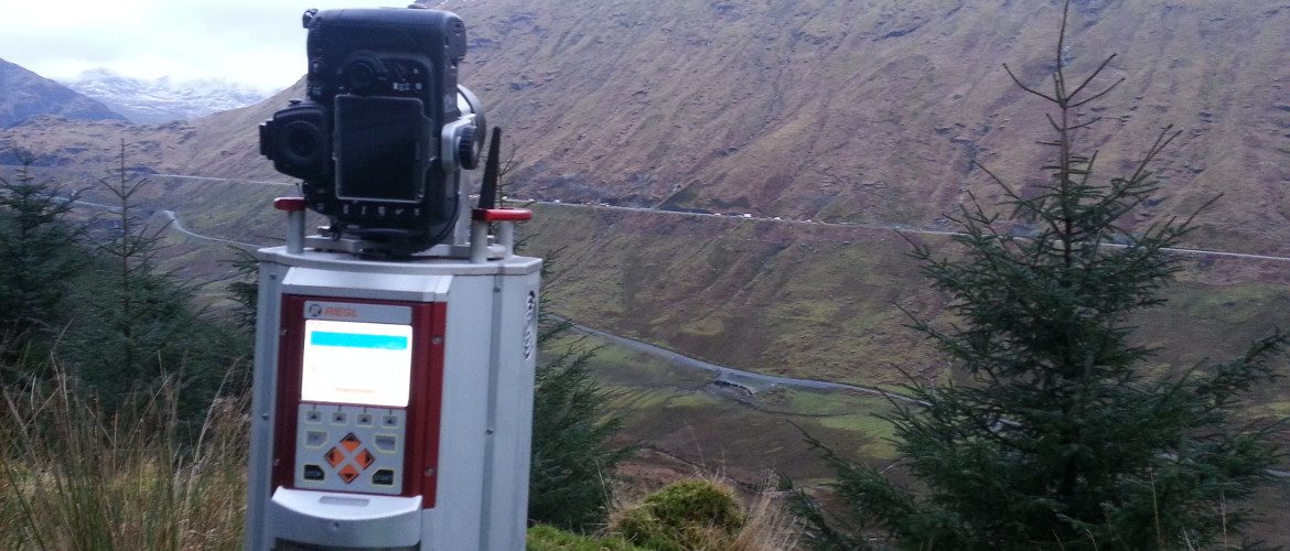
There are times when flying a drone or light aircraft is not an option. This can be due to bad weather, legal or client restrictions, survey specifications, ground cover or CAA no fly zones.

AIMS has the option of using our Riegl VZ1000 High Accuracy, Long Range Scanner.

Contact Us:

3, The Bridge Business Centre, Beresford Way, Chesterfield, Derbyshire S41 9FG 01246 268444

RSS AIMSurveys

  • SLAM vs VZ400i
  • The Best Topographical Surveys.
  • Photogrammetry or LiDAR
  • Measured Building Surveys.
  • Heritage Site Survey Solutions
  • Forest Mapping.
  • Best SLAM Surveys.
  • Reality Capture
  • Land Surveying Large Sites.
  • Cement Plant Surveys.

· © 2026 AIMSurveys · Designed by Press Customizr · Powered by ·