Start making better decisions today, based on accurate aerial data
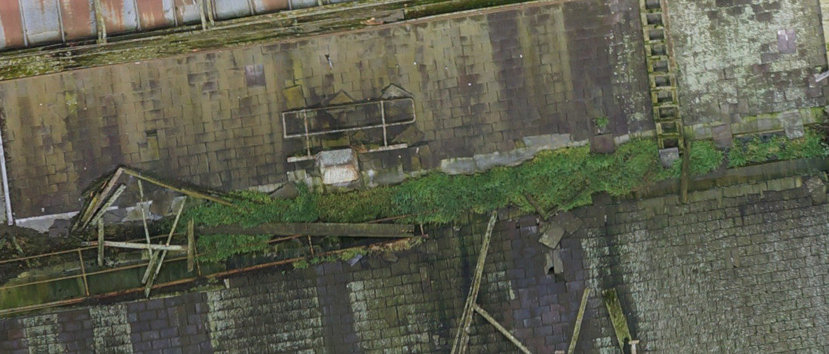
Roof Inspection using a drone.
Detail geo-referenced image that can be used to quantify work required.
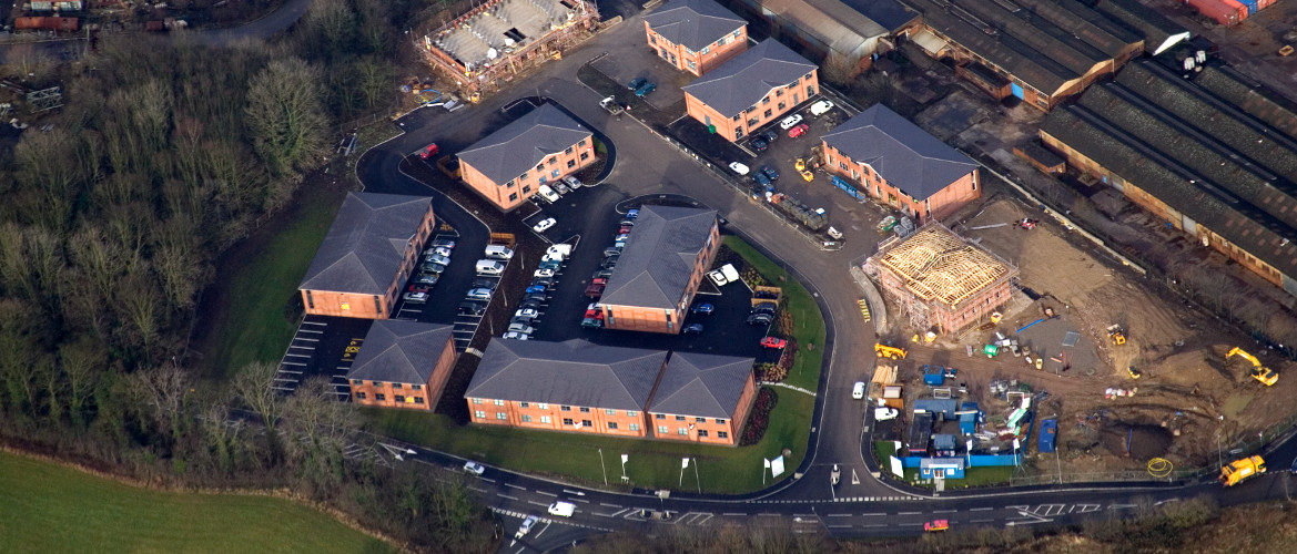
Our Offices
Just a simple image showing our Business Park under construction.
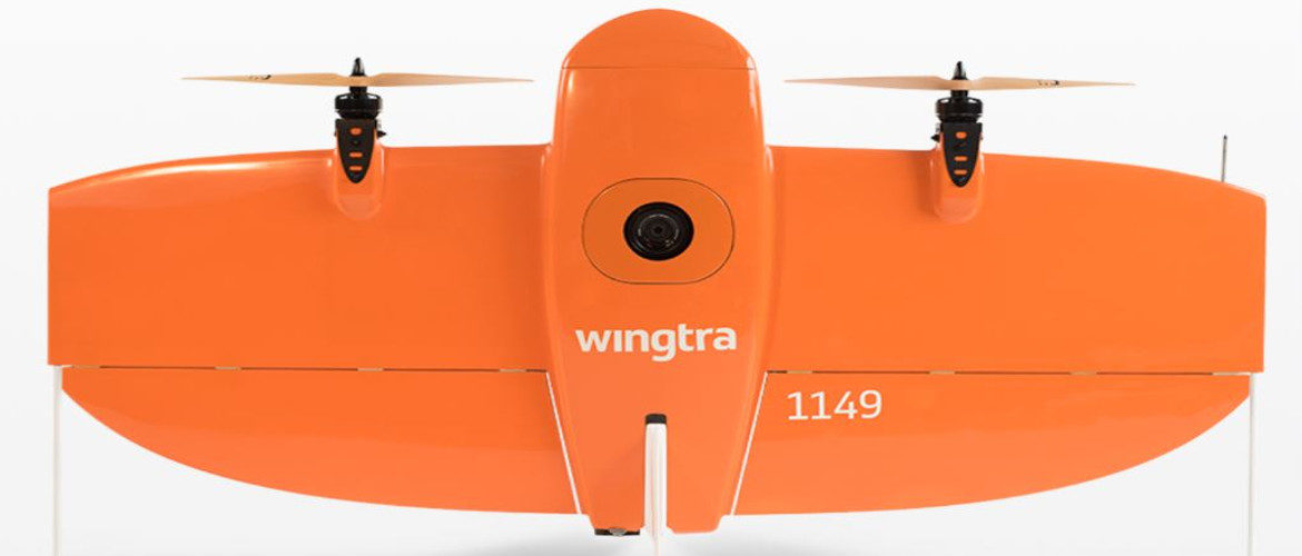
Wingtra One PPK
1cm Accuracy
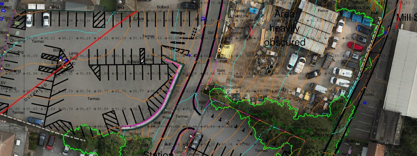
Typical Aerial Survey
Topographical survey done with a survey grade drone.

Bridge Inspection
We offer a drone with both camera and LiDAR.
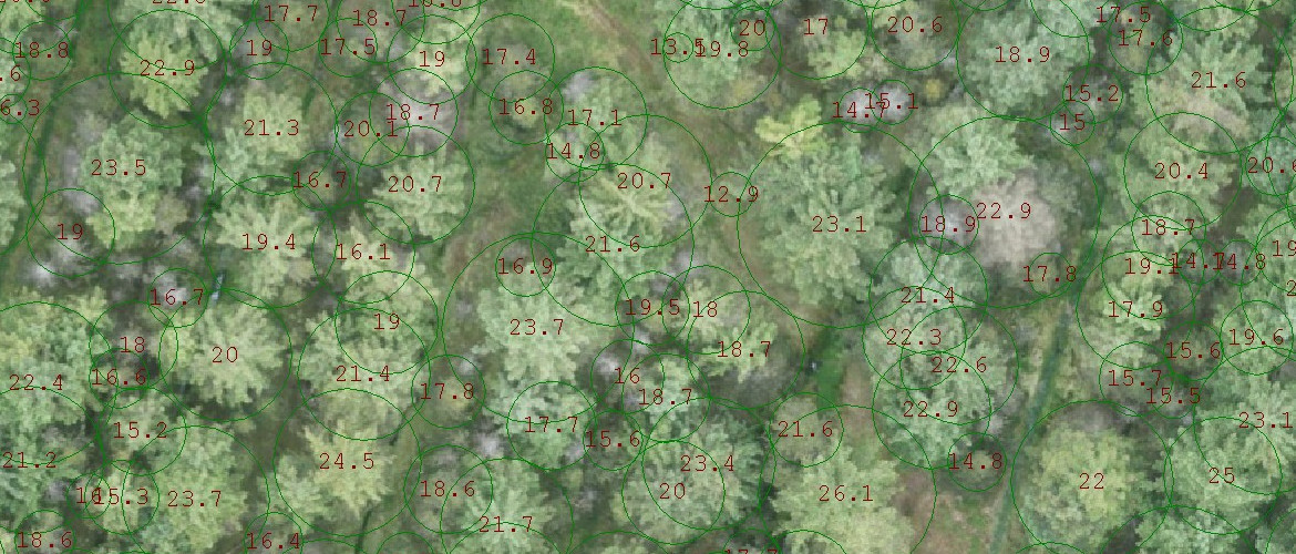
Forest Mapping using LiDAR
Aerial surveying offers a solution when tree detail is required over vast areas.
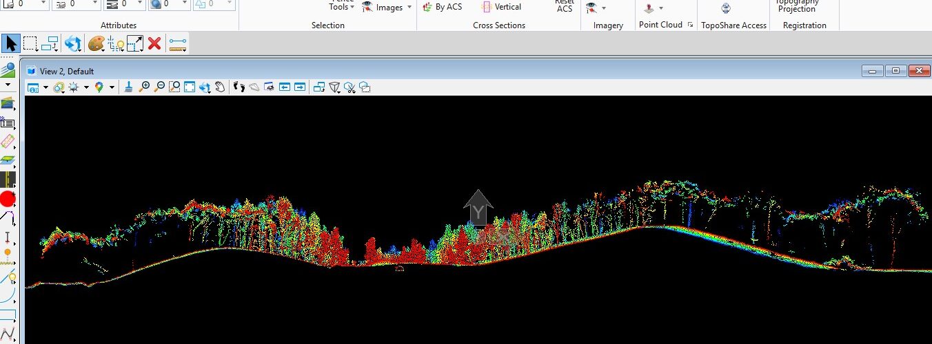
Aerial Photogrametry plus LiDAR
Terrain Mapping in densley vegetated areas.

3D Model.
Created using a smart oblique aerial system.

KellingleyColliery
One of the last images before it was demolished.

Complex Plant Detail.
A 2D plan extracted from an Aerial Survey