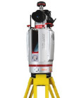
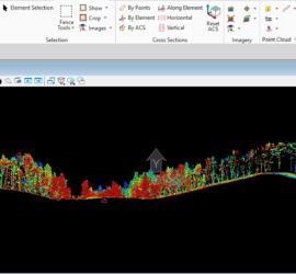
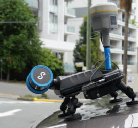
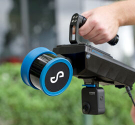
John Halifax


The Best Topographical Surveys.   Recently updated !

The Best Topographical Land Surveys are the most accurate, the most precise and most cost effective. They must include the correct level of detail and must be surveyed and delivered in the most appropriate format. We produce high resolution geo-referenced images that can be used in CAD software. These images […]


Photogrammetry or LiDAR   Recently updated !

When should we use Photogrammetry and when should we use LiDAR? Our opinion is; if you require the best results use both. And use both terrestrial and aerial data capture. Photogrammetry uses photos to create 3D models, excelling in rich color/texture and cost-effectiveness, while LiDAR uses lasers for highly accurate, […]


Measured Building Surveys.   Recently updated !

Updateing Measured Building Surveys to include data capture methods using survey grade drones, terrestial laser scanners and SLAM Technology. And adding reality models to the list of deliverables.  A measured building survey is the process of precisely measuring a building’s dimensions, layout, and structural features to create accurate technical drawings or […]


Heritage Site Survey Solutions

A recent Heritage site survey project involved detailed spatial and condition assessments of historic buildings, landscapes, and an archaeological site using technologies that included 3D terrestrial laser scanning, SLAM scanning, aerial LiDAR and photogrammetry both aerial and terrestrial. These surveys created precise digital models (digital twins) and detailed records of a site’s […]


Forest Mapping.   Recently updated !

Forestry: Asset verification, mapping, measurement and valuation. To measure trees accurately you need to deploy both photogrammetry and LiDAR-equipped devices on drones or backpack. Photogrammetry provides ortho-rectified, geo-referenced images, visual verification of the asset. Drone mounted LiDAR penetrates the forest canopy to provide accurate measurements of individual tree spread and height […]


Best SLAM Surveys.   Recently updated !

Why did we upgrade to the new Hovermap STX. Because it combines SLAM and GPS for precise mapping making it, in our opinion, the best SLAM scanner on the market. The Hovermap STX with GPS provides more accurate, higher-density 3D mapping with a 300m scanning range, double the laser sensors of […]


Reality Capture   Recently updated !

What is Reality Capture Reality capture is the process of digitally documenting a physical environment to create an accurate 3D model, such as a point cloud or mesh. This is achieved using technologies like laser scanning or photogrammetry (using photographs) and can be used for applications in construction, architecture, and surveying to document existing conditions, […]


Land Surveying Large Sites.   Recently updated !

Upgrading to the WingtraGen II. It’s worth it for professionals like us, focused on fast, high-accuracy mapping and surveying, especially we need to cover large areas efficiently and require reliable data without constant use of ground control points.  The upgrade offers improved construction, flight safety, and landing precision, faster data […]


Cement Plant Surveys.   Recently updated !

Mapping in a very challenging environment. What do you do when you have a very complex site with limited access, a hot dusty environment and the whole area is vibrating? Oh, and the clients says I just need to know where I can fix 6 anchor points……….and we need to […]


SLAM Scanning.   Recently updated !

Introducing our latest acquisition, to improve efficiancy and reduce costs. The Hovermap ST. Keeping cost down is always important to us, terrestrial scanners like our Riegl Scanners the VZ1000 and the VZ400i are normally our go to tools and offer sub 5mm accuracy but they are static scanners, and they […]