
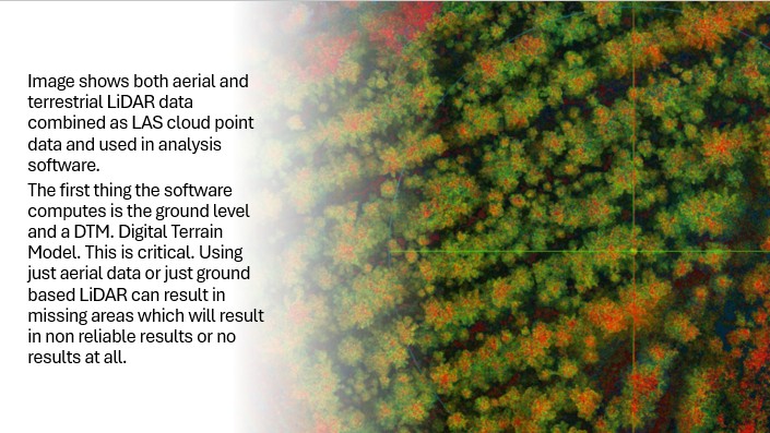
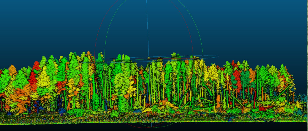
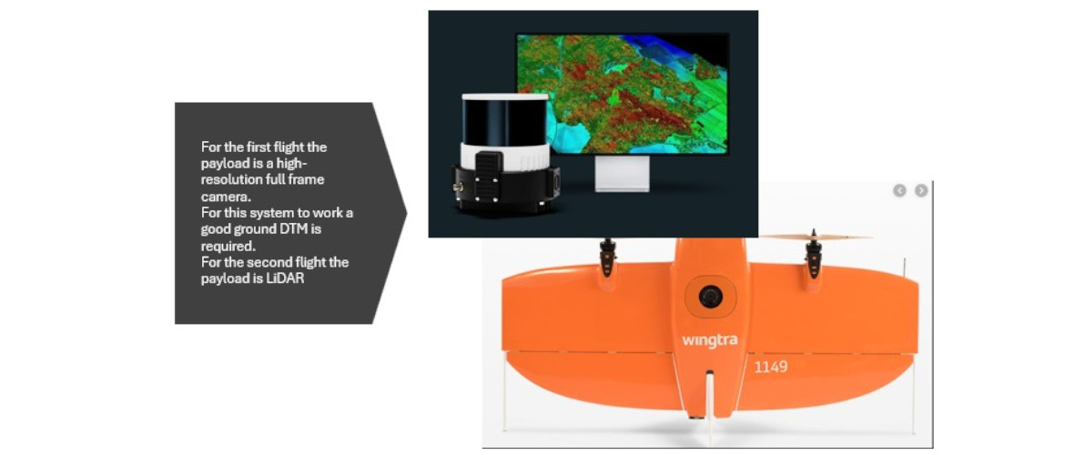
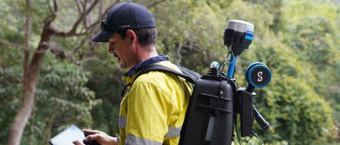
Detailed Forest Mapping, utilising the very latest in Aerial LiDAR, Photogrammetry and Terrestrial Geo-Referenced SLAM technology.
We can now map hundreds of hectares in hours rather than days.
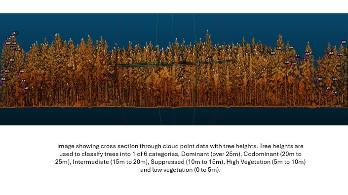
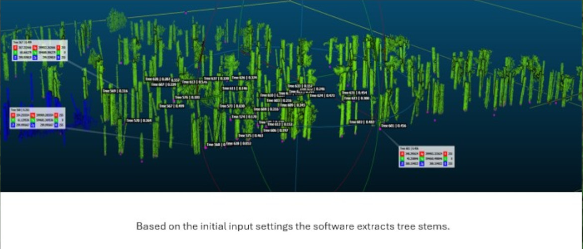
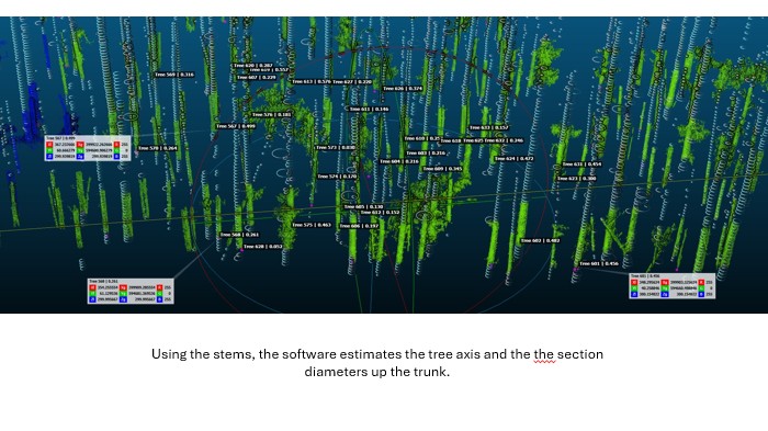
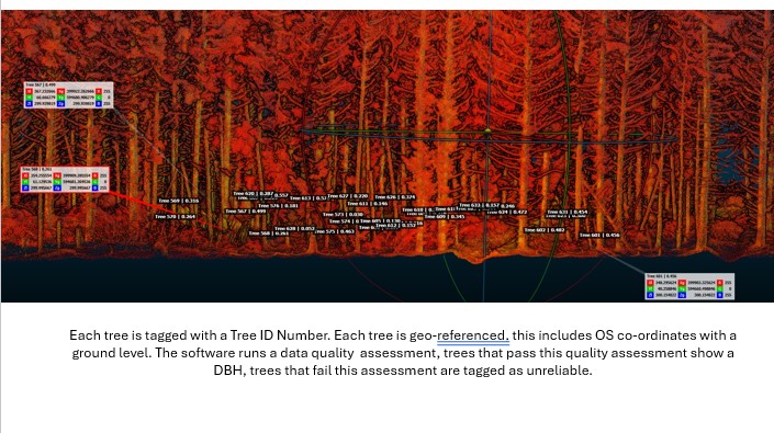
Using our software we are able to extract accurate data for thousands of trees, including a digital terrain model, tree canopy, tree heights and diameter at breast height.
Our specialist in Forest Mensuration and inventory analysis, can provide owners or agents with a detailed, comprehensive estimate of the timber stocks and growth rates in a forest, to aid in buying, selling or valuation of their forest assets.