Back Home

Start making better decisions today, based on accurate aerial data

Start making better decisions today, based on accurate aerial data

  • Home
  • Services
  • News
  • Contact/Find Us

Monitor structural deformation

Monitoring slope stability

3D rock face reconsturction

‹
›
Home » Infrastructure Inspection » Structural Monitoring

Recent Posts

  • AIMS take delivery of the 1st Wingtra One PPK in the UK
  • AIMS Joins Mining Surveys (UK)
  • AIMS Works on Last Deep Coal Mine in Britain
  • Multirotor Mapping Drone For Sale
  • About Us
  • Mining Surveys, TLS and AIMS Have Joined Forces
  • LSS Software Now Gives You More Control Over Your Point Cloud Data

Services

  • Aerial Surveys
  • Environmental Monitoring
    • Flood Monitoring
    • Land Slide Monitoring
    • Visual Impact
  • Highway Surveys
  • Infrastructure Inspection
    • Structural Monitoring
  • Photography and Filming
  • Railtrack and Infrastructure
  • Underground Mapping Services
  • Visual Impact
  • Deep Mine Surveys
  • Development Site Surveys
  • Electricity Grids & Distribution Networks
  • Hydrographic Surveys
  • Landfill
  • Oil & Gas Distribution and Infrastructure
  • Opencast Coal
  • Quarry Surveys
  • Stock Surveys
  • Terrestrial Laser Scan Surveys
  • Topographical Surveying

Structural Monitoring


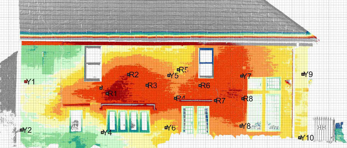
AIMS uses Trimble precision electronic levels to monitor movement to 10ths of a millimetre. This can be done on hundreds of points but it is time consuming and costly and only records particular positions.

Laser scanning can offer millimetre accuracy over very large areas.

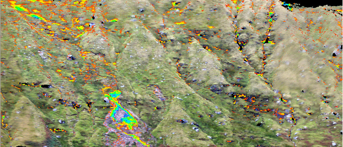
The Wingtra One PPK can monitor vast areas to centimetre accuracy.

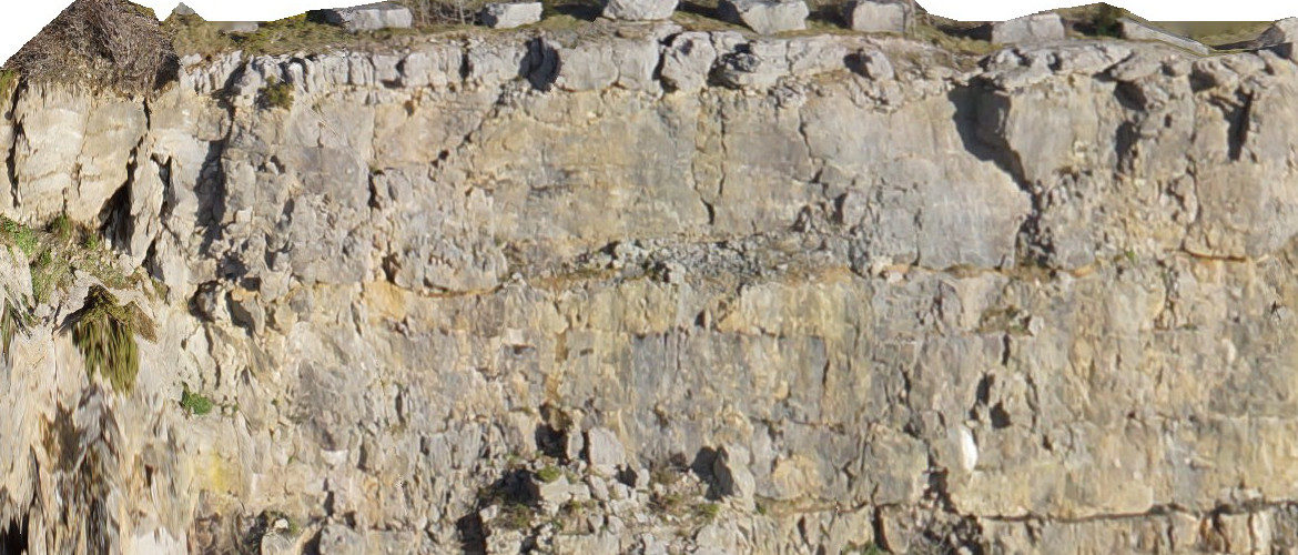
Our XR6 multi rotor offers 2-3cm accuracy.

Contact Us:

3, The Bridge Business Centre, Beresford Way, Chesterfield, Derbyshire S41 9FG 01246 268444

RSS AIMSurveys

  • AIMS take delivery of the 1st Wingtra One PPK in the UK
  • AIMS Joins Mining Surveys (UK)
  • AIMS Works on Last Deep Coal Mine in Britain
  • Multirotor Mapping Drone For Sale
  • About Us
  • Mining Surveys, TLS and AIMS Have Joined Forces
  • LSS Software Now Gives You More Control Over Your Point Cloud Data

· © 2025 AIMSurveys · Designed by Press Customizr · Powered by ·