Aerial Inspection and Mapping Surveys Ltd was formed in 2015, to provide a safe and modern surveying and design service. AIMS works with specialist survey grade equipment and surveyors with over 30 years’ of experience. The company considers that today we remain at the forefront of surveying, mapping and measurement technology.
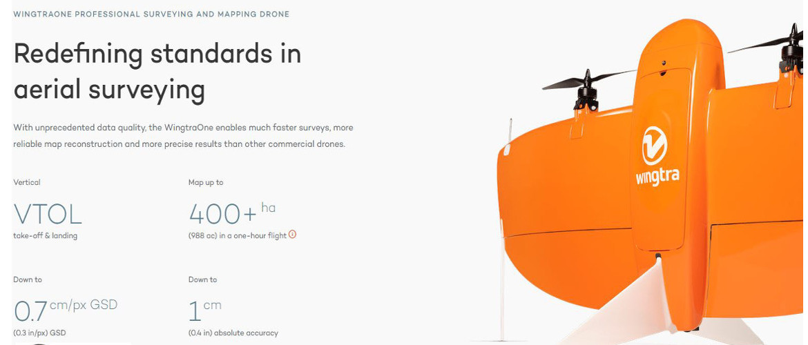
Aerial Inspection and Mapping Surveys Ltd (AIMS Ltd) was developed to keep up-to-date with the latest remote surveying technology by using UAVs to conduct surveys. We have fully qualified and insured CAA pilots to carry out UAV surveys in the UK and abroad.
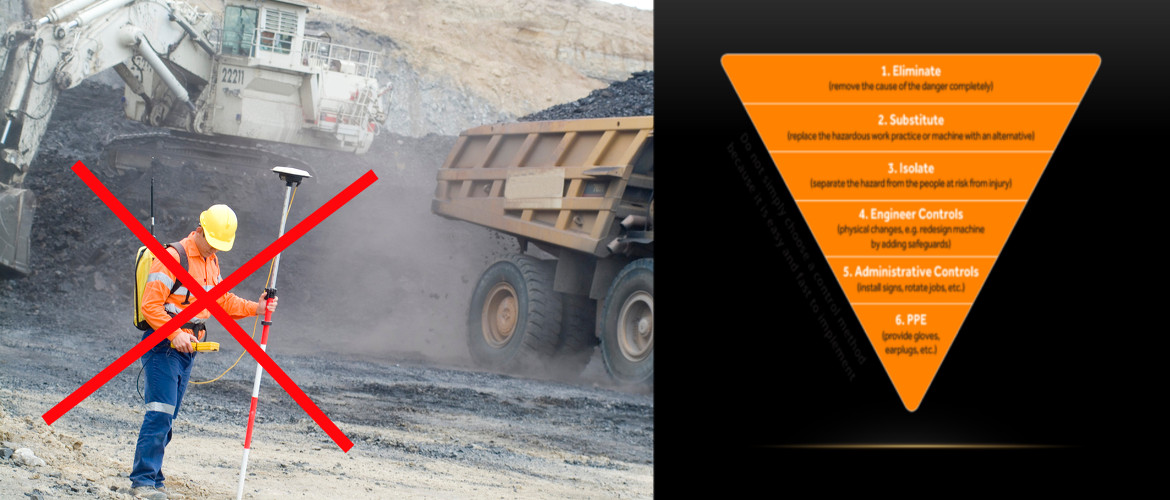
AIMS Ltd use numorus UAVs and the Worlds Best Terrestrial Laser Scanner for Topographical Surveys, Measured Building Surveys, Mapping, Monitoring and Inspection. Having the ability to accurately survey hazardous areas where it is difficult or dangerous to place a pedestrian surveyor. Speed of data acquisition is unsurpassed.
Our software has also kept pace with the ever more sophisticated hardware and we use a whole range of software packages.
We are enthusiastic LSS users, amongst other applications.
![]()
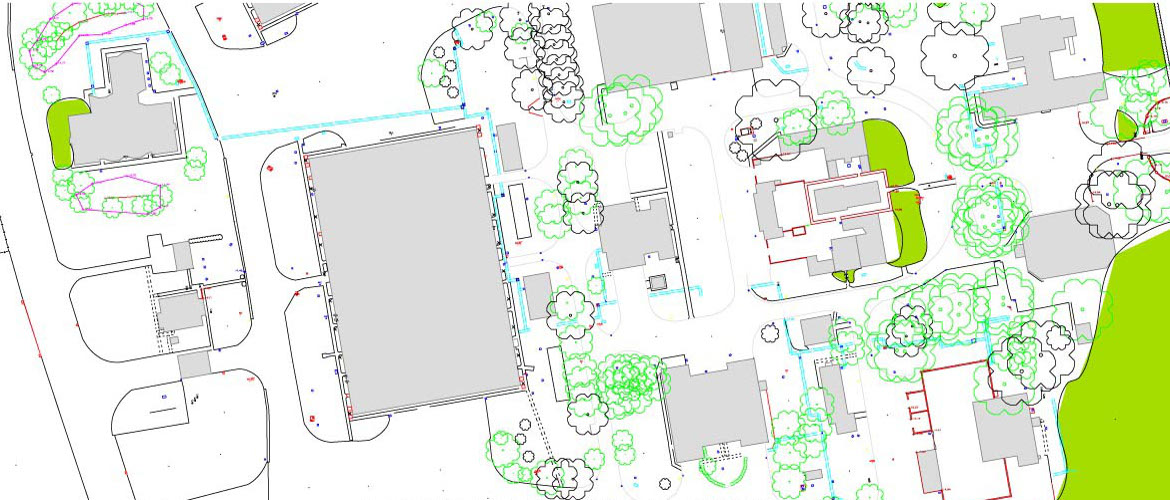
LSS 3D Vision was developed after consultation with Mining Surveys (UK) Ltd – our other company – and is exceeding all expectations. This software is a low cost alternative that allows our clients the opportunatey to produce plans of ther own from the cloud point data we provide.
The surveying industry has seen many technological breakthroughs in recent years. We are constantly aware of all the new methods of surveying and we enthusiastically embrace the best of these technologies, analysing them thoroughly against our tried and tested principles. In doing this, we provide our clients with an unparalleled, professional surveying and mapping service.
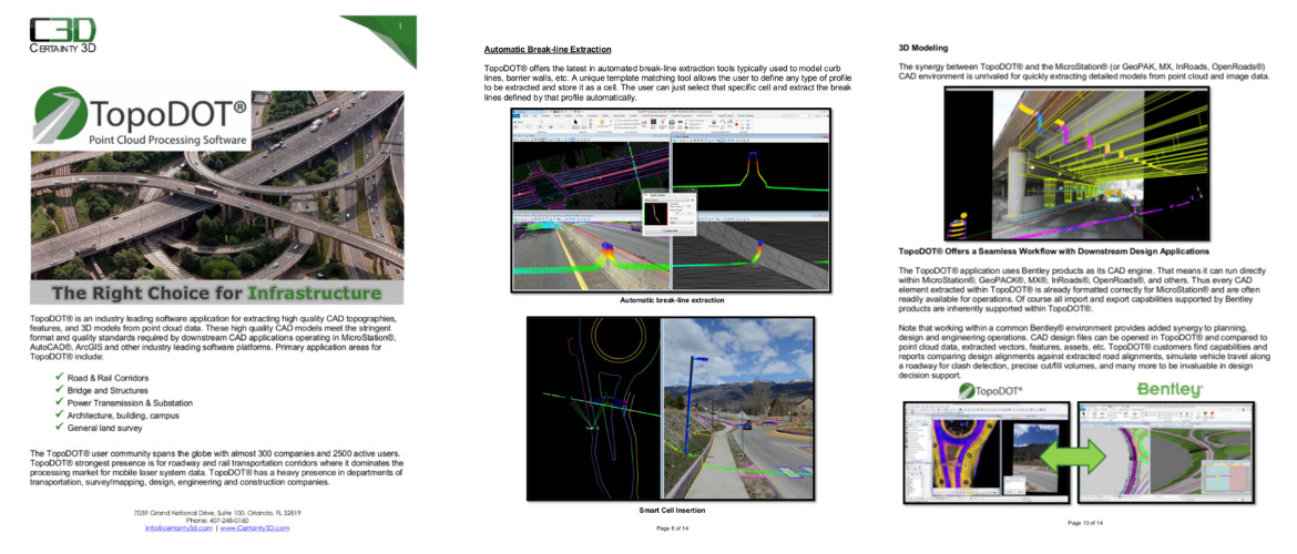
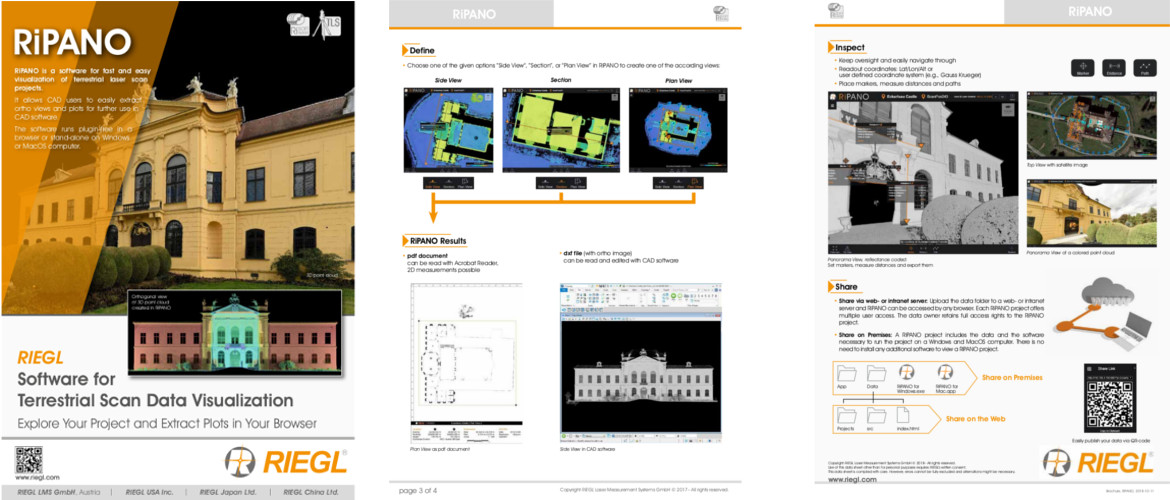
We now offer, as part of our terrestrial surveying package, RiPANO. This is a software for fast and easy visualization of terrestrial laser scan projects. It allows CAD users to easily extract ortho views and plots for further use in CAD software. The software runs plugin-free in a browser or stand-alone on Windows or MacOS computer.
Start making those better decisions today with accurate terrestrial and aerial data.