Back Home

Start making better decisions today, based on accurate aerial data

Start making better decisions today, based on accurate aerial data

  • Home
  • Services
  • News
  • Contact/Find Us

3D DTM From Stock Data

Existing Layout and Levels

Proposed Factory Units

Proposed Development

‹
›
Home » Private: Surveying and Mapping » Development Site Surveys

Recent Posts

  • AIMS take delivery of the 1st Wingtra One PPK in the UK
  • AIMS Joins Mining Surveys (UK)
  • AIMS Works on Last Deep Coal Mine in Britain
  • Multirotor Mapping Drone For Sale
  • About Us
  • Mining Surveys, TLS and AIMS Have Joined Forces
  • LSS Software Now Gives You More Control Over Your Point Cloud Data

Services

  • Aerial Surveys
  • Environmental Monitoring
    • Flood Monitoring
    • Land Slide Monitoring
    • Visual Impact
  • Highway Surveys
  • Infrastructure Inspection
    • Structural Monitoring
  • Photography and Filming
  • Railtrack and Infrastructure
  • Underground Mapping Services
  • Visual Impact
  • Deep Mine Surveys
  • Development Site Surveys
  • Electricity Grids & Distribution Networks
  • Hydrographic Surveys
  • Landfill
  • Oil & Gas Distribution and Infrastructure
  • Opencast Coal
  • Quarry Surveys
  • Stock Surveys
  • Terrestrial Laser Scan Surveys
  • Topographical Surveying

Development Site Surveys


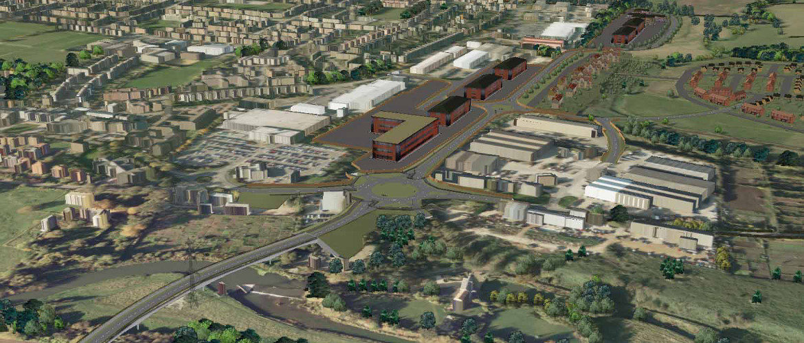
AIMSurveys use the latest technology to produce the initial plans required for a feasibilty study.

We can gather together existing data for a site as part of a desk top study.

This data is then out-put in a 3D model with site detail spot levels and contours.

The plans produced  can aid in determining the placement of roads, railways, reservoirs, dams, pipelines, retaining walls, bridges, solar farms and buildings.

Contact Us:

3, The Bridge Business Centre, Beresford Way, Chesterfield, Derbyshire S41 9FG 01246 268444

RSS AIMSurveys

  • AIMS take delivery of the 1st Wingtra One PPK in the UK
  • AIMS Joins Mining Surveys (UK)
  • AIMS Works on Last Deep Coal Mine in Britain
  • Multirotor Mapping Drone For Sale
  • About Us
  • Mining Surveys, TLS and AIMS Have Joined Forces
  • LSS Software Now Gives You More Control Over Your Point Cloud Data

· © 2025 AIMSurveys · Designed by Press Customizr · Powered by ·